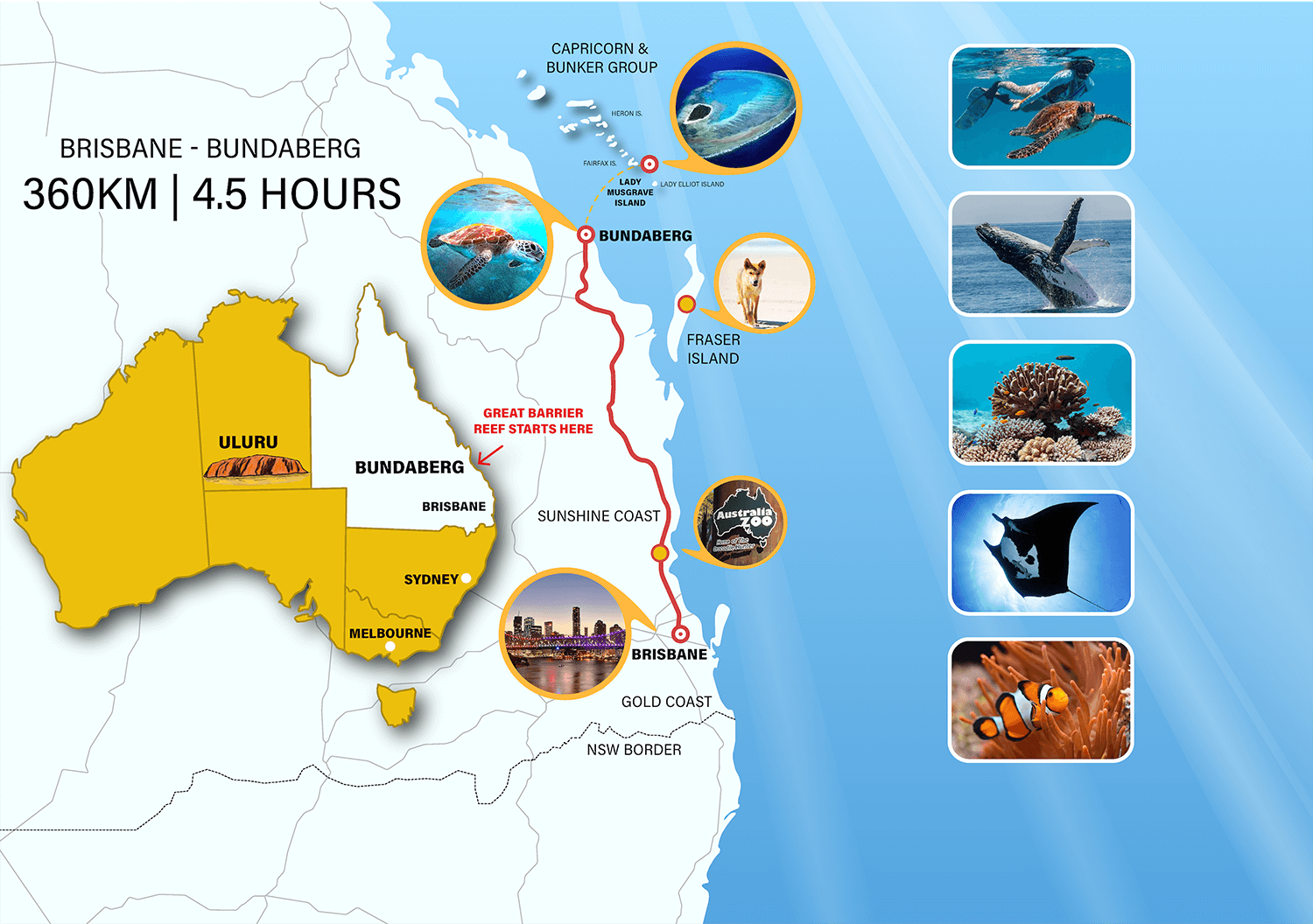
Getting Here, Bundaberg Region
Planning a visit to the beautiful Bundaberg region? Here’s how you can get there using Google Maps, ensuring a smooth and enjoyable journey to this charming part of Queensland.
By Car:
- Starting Point: Open Google Maps on your smartphone or computer.
- Enter Your Destination: Type “Bundaberg, Queensland” into the search bar.
- Choose Your Route: Google Maps will provide several route options. Select the one that best suits your travel preferences. For example:
- From Brisbane: The most direct route is via the Bruce Highway (A1), which typically takes around 4.5 to 5 hours. Follow the A1 north until you reach Bundaberg.
- From the Sunshine Coast: Head north on the Bruce Highway (A1). The journey takes approximately 3.5 to 4 hours.
- Start Navigation: Click on the “Start” button, and Google Maps will guide you with turn-by-turn directions to Bundaberg.
By Public Transport:
- Open Google Maps: Enter your starting point and select “Bundaberg, Queensland” as your destination.
- Choose Public Transport: Select the public transport icon (usually a bus or train) to view available options.
- Plan Your Trip: Google Maps will show you various options including train, bus, and combinations thereof. For example:
- From Brisbane: You can take the Queensland Rail train from Brisbane to Bundaberg. The trip typically takes around 4.5 to 5 hours. Check the timetable for the latest schedule.
- From the Sunshine Coast: Take a bus or train to Brisbane, then catch a train to Bundaberg.
By Air:
- Locate Airports: Use Google Maps to find your nearest airport and search for flights to “Bundaberg Airport.”
- Plan Your Route: Once you land at Bundaberg Airport, you can use Google Maps to get directions to your accommodation or desired destination in the region.
Using Google Maps:
- Download Directions: For offline access, download the map and directions to your phone.
- Explore Routes: Check different routes and estimated travel times. Google Maps will provide real-time traffic updates and suggest the fastest route.
- Search for Stops: Add stops for rest, fuel, or food along the way.
Getting to Bundaberg is easy with Google Maps, offering a variety of travel options to suit your needs. Whether you’re driving, taking public transport, or flying, Google Maps will help you find the best route and make your journey to the Bundaberg region an enjoyable experience.

